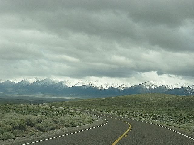

The first stop today was in the first town I reached, Austin, which is 70 miles from Eureka. A tiny town clinging to a hillside at 6,700 feet of elevation, where I made a pit stop and picked up a pin proclaiming I had survived the "Loneliest Road" (even though I haven't yet survived it, I'm only halfway along it). Though surviving it now is hardly the challenge it was when the Pony Express riders galloped along the same route. I was surprised to learn that, for all it's gloried place in American history, the Pony Express was only in business for a total of 17 months during the U.S. Civil War.

The second stop would have been Hickison Summit Petroglyph Site, but the dirt road leading back to it had been converted to a mud pit by the previous day's snow and rain. I thought it best to not get the Pony stuck and just continued on.
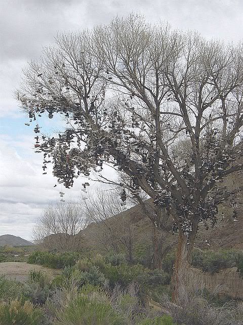
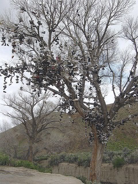
Made one unplanned stop next to the most amazing cultural marker I think I've ever seen: an old tree hung with shoes. It had obviously begun with some pair that had the laces tied together and then was flung across a branch, but people then became more creative. I saw a pair of cowboy boots that someone had strung together and then flung up. For how long have people been flinging shoes into this tree? What sort of history of shoe fashion could be written from analysis of the shoe tree's branches? Did the person who threw the first pair have any conception of what they'd begun? It was absolutely fascinating.
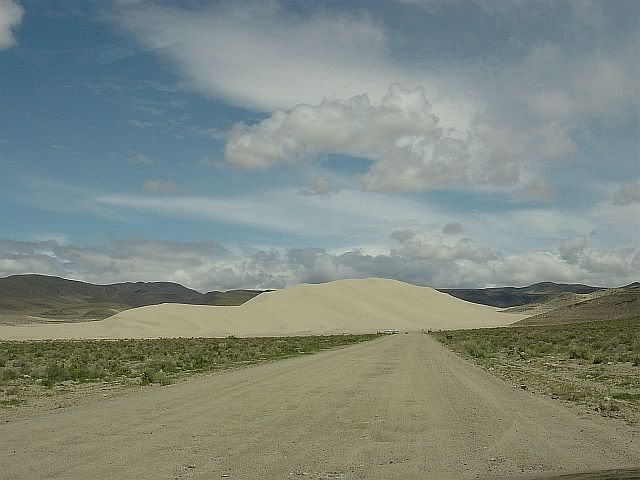
The third planned stop would have been Sand Mountain, a huge sand dune between a mountain range and a sandy, salty flat. I turned and headed along the pitted dirt road leading to it, but as I approached I could hear and see ATV's churning along the base of the dune. The noise and disruption made me again choose to move on, after snapping a couple of photos (including one of the solar-powered phone at the entrance, which a sign along 50 proclaims the "Loneliest Phone"). The passage along the sand flats was bordered by dozens of spots where people had apparently gathered rocks from the basin and used them to spell out names and slogans ("I love so & so", etc).
The fourth planned stop was Grimes Point Petroglyph Site, at which I was finally able to get in another hike. In spite of the great trail and the dramatic view from the overlook, there was an unfortunate disruption here, too: jets flying in and out of the air force base at Fallon, just a few miles from the petroglyph site. I had to keep telling myself that it was the wind blowing, not planes, just the wind...
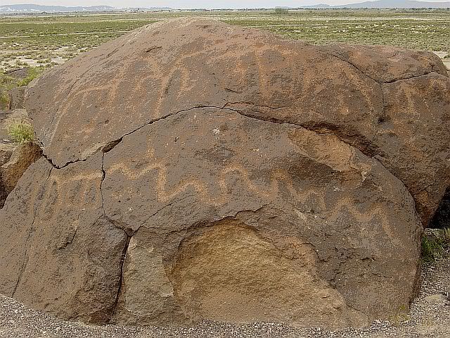
While the petroglyphs were cool, what really gave me pause was an interesting sign at the overlook: In contrasting the life of hunter-gatherer tribes who entered the area 8000 years ago to life in the area today, the sign mentioned that the current population of the area is approximately 300,000 people within a two hour drive. The town of Gaithersburg, MD, where this trip began, has a population within it's town limits of almost 400,000. It's gonna be hard to go back home to that.
The fifth planned stop today was to be in Fallon because the Road Trip USA website mentioned a nifty sounding museum there, and I assumed that there would be places to eat (the military's gotta eat, right?). But, I couldn't find the Churchill County Museum and the food choices were so slim I ended up at Jack In The Box.
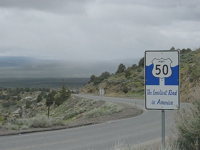
Technically, the "Loneliest Road" section of 50 runs all the way to Carson City, the capital of Nevada. It may as well stop at Fallon. West of Fallon, below the same sort of mountain ranges of the last few hundred miles, the basin area is scattered with ugly little pockets of mobile homes, single-story ranch-type houses, gas/convenience/casino combinations,and a whole lotta traffic. Took one detour up Route 341 to Virginia City and very literally up it was, too. A 15% grade snaking it's way up through the still functioning yet historic mining towns of Gold Hill, Silver City and then into Virginia City. It's pretty apparent that the producers of the old tv show Bonanza never actually visited the town in which the show supposedly took place. Either that or they decided that the aerial location of the real Virginia City just wouldn't translate well on tv.
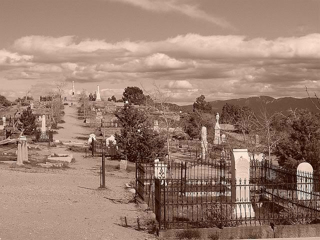
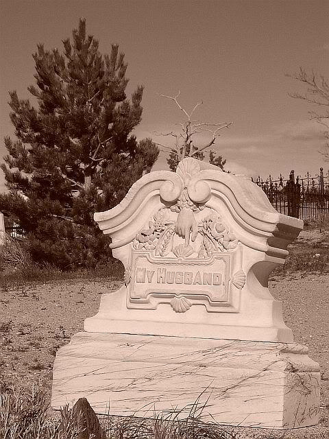
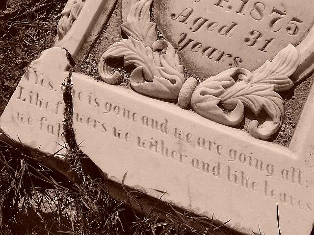
I was looking for the Red Light Museum (not a museum of traffic signals. Just as well that I didn't find it, considering the comments at that link), but instead ended up at the Comstock Cemetery, one of the coolest burial grounds I've ever seen. Flowing up and over a hill on the edge of the town were graves dating from the early 1800's through the present day. I'm guessing the oldest were the wooden grave markers that were so weathered as to be unreadable.
Heading back through the main street of Virginia City I tried again to find the Red Light Museum, but if it was there it was buried among the kitschy Wild West-style museums, "saloons" and souvenir shops that I never would have expected to find tucked away all the way up that road. There was even a Mark Twain museum (Twain spent a portion of his newspaper career in Virginia City). I could easily imagine Twain clucking his tongue at all the tourists wandering the town today.
After the awesome, empty openness of eastern NV, Carson City is one hell of a shock. It's like a mini-Reno, with it's own Nugget Casino and everything. I was fortunately able to find a funky little coffee shop, where I'm debating whether to find a hotel there or continue on to South Tahoe. I'm more than tempted to head back to Eureka, in the middle of the loneliest section of the Loneliest Road.
Wal-Mart count as of Carson City= 17, plus the 2 distribution centers.
(For more images of the Lonely Road through Nevada, click here.)


No comments:
Post a Comment