skip to main |
skip to sidebar
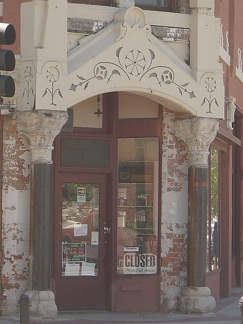
End of the line. Spent last night in a Best Western in the Soma district of San Fran. I thought about taking an evening wander through the city, but decided that I was pooped from fighting the rush hour traffic coming from Berkely. So, I stayed in and hit the sack early.

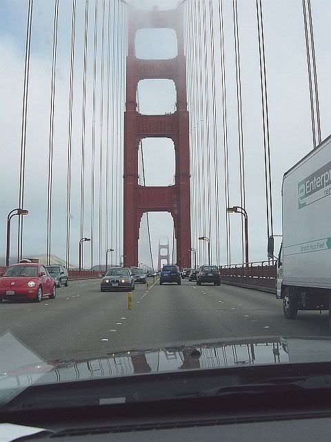
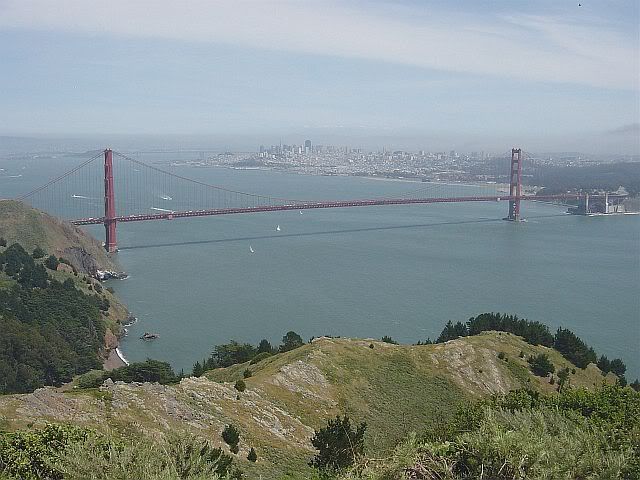
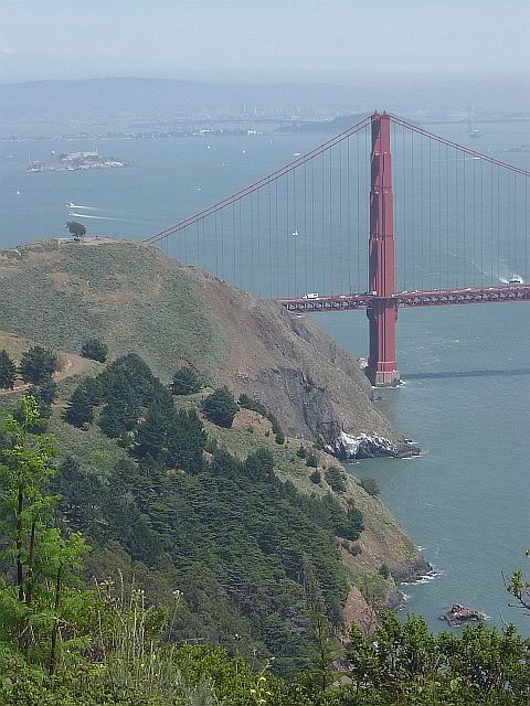
This morning I got up, packed, grabbed breakfast in the hotel (first hotel in which I've ever had to pay for the continental breakfast), and made it across the Golden Gate Bridge and up to Muir Woods National Monument by 8:30 am.

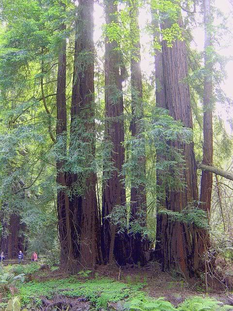
Even that early, though, there were a couple of big troops of people: One of Germans who split up and wandered about in smaller groups; the other a bunch of senior citizens, all outfitted with packs and trekking poles, who chattered so loudly that I heard them 5 minutes before I saw them behind me on the trail.

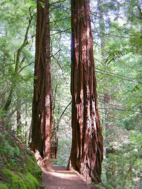
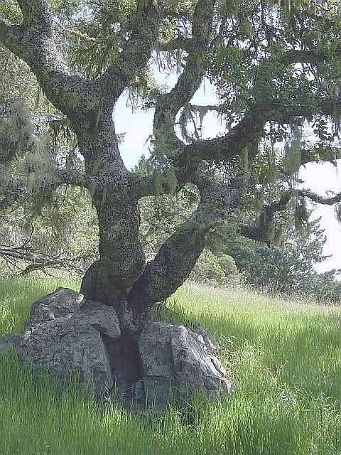
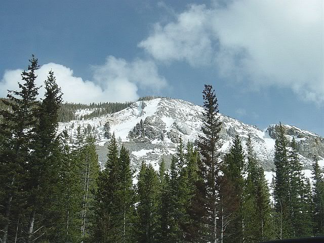
Like other things I've seen on this trip, I can't begin to describe the giant redwoods and I don't think my photos fully captured the effect of them. They were probably hundreds of years older and three times as tall as any tree I've seen on the east coast. The trail I took was a loop that started out from the main area around the visitor's center, then worked it's way fairly steeply along the side of a ridge. Below and around the trail, redwoods and ferns predominate. After climbing 900 feet or so, it was interesting to be almost on a level with the tops of trees growing up from the floor of the forest.
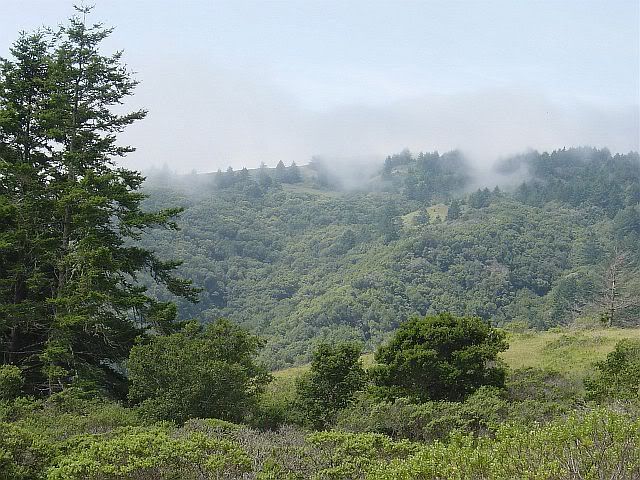
Crossing over the top of the ridge, the trail passes out of the redwood forest into a meadowy, wooded section that would have overlooked the coast if it hadn't been so foggy that morning. I did get a glimpse of Mt. Tamalpais, though, to the north.


Back at the visitor's center after my hike, it was very funny to listen to the tourists chatter and take photos of each other with their arms stretched out in front of one of the nearby giants, and to think of how ancient these woods are. All of our petty concerns really are inconsequential in comparison. To borrow a section from Abbey's Desert Solitaire, (changing the desert references to forest, of course):
"How difficult to imagine this place without a human presence, how necessary. I am almost prepared to believe that this sweet virginal primitive land will be grateful for my departure and the absence of the tourists... Grateful for our departure? One more expression of human vanity. The finest quality of this stone, these plants and animals... is the indifference manifest to our presence, our absence, our coming, our staying or our going."

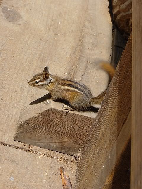
It's a great thing that someone was awed enough by this place to preserve it, so that a bunch of other people can now run around here being silly and acting as if it were nothing but an amusement park of big trees and tame chipmunks.
I'm always torn in places like this. I'm incredibly grateful that it has been preserved. And then, of course, I have to admit that the tourists are a necessary evil. If they didn't come here and gawk, this land would be lost to the damned developers, the redwoods would be churned up, and these fern-covered hillsides would be turned from an amusement park into high income 'estate homes' or worse. As disruptive as they are, the tourists actually help to protect the place. If only they could be more respectfully awed and less chatty...
But enough with my ranting. Time to get off the soapbox and steer the Pony back down to San Fran... I may have time to hit the Haight before heading to the airport.
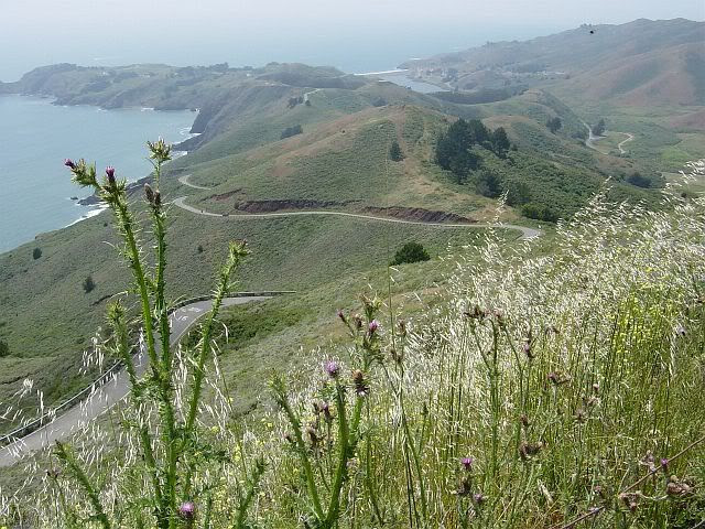
My hat's off to whoever put in the roads leading up to and back down from Mt. Tamalpais and Muir Woods. The longest, tightest, curviest stretches of road I've ever been on. Too awesome. I ended up doing some cruising around the Marin Headlands and Golden Gate National Recreation Area to get some photos. More great curvy roads along with the terrific views. Stopped and wandered around Hawks Hill, where the military had built an overlook and bunkers to protect the bridge. The bunkers, etc are now defunct and in ruins, but the hill's apparently well-known as a spot for migratory bird-viewing. Got to see the moon-rise in the middle of the afternoon when I came around a curve in the trail and caught a young couple who had apparently mis-judged the solitude of the area. The view was definitely gorgeous (not the moon, though, it was a tad pudgy), but I have to admit I was most excited over getting close-up photos of a pair of ravens that were also wandering around that afternoon. (Post-trip note: The raven photos are not very good quality, so they're not posted here. Ravens are, unfortunately, very fidgety models.)


Back across the bridge in San Fran, I took a quick spin around Golden Gate Park to the Haight-Ashbury section of town and found my favorite sort of lunch spot: Rockin' Java, a very funky, punky coffee shop on Haight Street. Spinach lasagna, salad, jasmine lemonade, and a cool atmosphere in which to relax before the stress of air travel.
At the airport, waiting for my flight after sadly parting company with the Pony and having been picked out for 'extra special handling' at the security check-in, I'm reading my notes and going through my photos, anything to try and re-live this trip that ended way too soon. In retrospect, there are places where I wish I had slowed down, spent more time and been fully present in the experience. And there are places I skipped over that I now wish I hadn't. But that's the thing about a road trip-- You just don't know what's ahead. Taking the time for something now could also mean missing out on something even better somewhere else. There's no predicting, and dwelling on hindsight only takes away from the experience. You can't regret or bemoan any parts you didn't enjoy or any thing you missed. You have to get something out of whatever you do experience, whether it's good, bad, or mundane. Besides, with any luck, those places passed over could very well form the springboard for a future trip (At least that's what I'd like to think). In the meantime, these notes and photos are my way to hold on to this particular 3,537 mile experience for as long as possible.
"...So in America when the sun goes down and I sit on the old broken-down river pier watching the long, long skies over New Jersey and sense all that raw land that rolls in one unbelievable huge bulge over to the West Coast, and all that road going......"
-- Jack Kerouac, On The Road (Too bad for Kerouac that he wasn't able to get his hands on a Ford Mustang... Click here for many more images of Muir Woods and the Marin Headlands.)
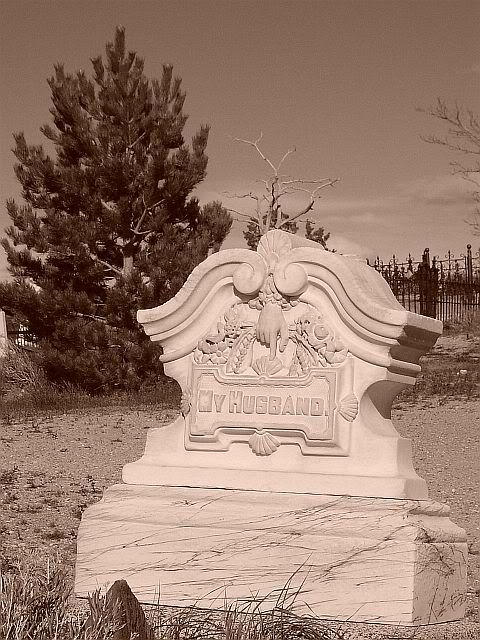
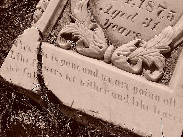
Of the two Best Western's in Carson City, NV, one is a multi-story with casino attached and the other is a traditional two-story 'motor court'. I went with the lower-key motor court last night and hit the Chinese place next door for dinner. Today's breakfast is at Heidi's Family-Style Restaurant, which has an alpine theme that seems out of place with the western glitz of Carson City. Makes sense, though, considering all the different nationalities that helped to settle the "Wild West". This was clearly pointed out yesterday in the Comstock Cemetery. A large percentage of the headstones included a line naming the country of which the deceased had been a native. I saw quite a few naming England or France, so a Germanic alpine place in Carson City is really just as authentic as any other.
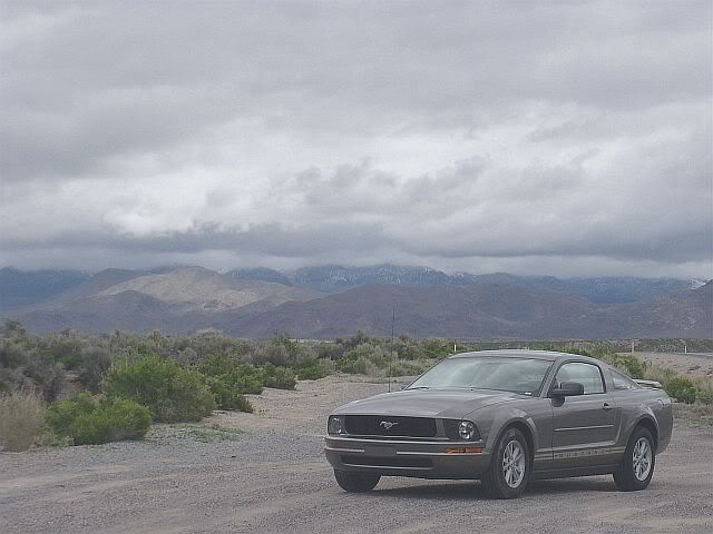
Today, of course, is bittersweet. As much as I'm looking forward to seeing California, crossing that state line is just a reminder that the trip is over tomorrow night. There've been times when I was tired from driving all day, and there've been places where I wish I could've spent more time, but overall I've been very comfortable with the nomadic lifestyle these past two weeks. And I'm gonna miss the hell out of the Pony.
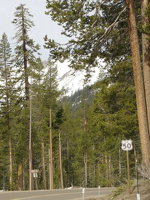
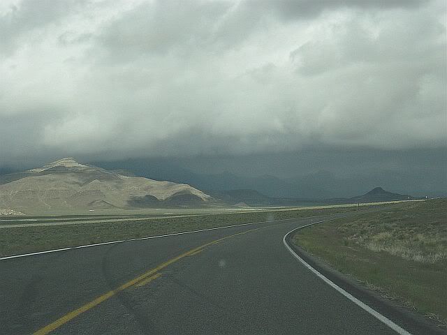
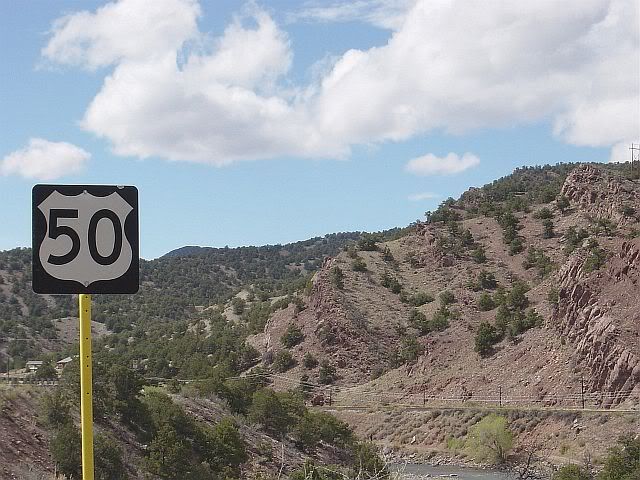
Roughly 200 miles later, I'm sitting in Spenger's Fresh Fish Grotto (a subsidiary of McCormick & Schmick's, I later learned), on 4th Street in Berkeley, CA. Back in NV this morning, I had stopped at the forest service office in Carson City to ask about places to hike around Tahoe and been told that all of the trails were most likely covered in snow. I headed toward Tahoe in the hopes of finding a trail at a lower elevation that might be clear. Route 50 around the lake reminded me of Deep Creek Lake in Garrett County, MD-- A beautiful place overtaken by lakefront homes, commerce and tourism. I did find one little strip of shops that included a hemp store (which wasn't open that morning, unfortunately), a bagel/coffee shop, and a natural foods cafe, where I picked up a smoothie. Everything else, though, was geared towards either seasonal tourists or the yuppies who can afford to live there. The town of Stateline (on the state line, of course) was like a mini-Vegas, with a half mile or so of 20-story casino hotels. I had been hoping to find at least one of the state parks located in Emerald Bay, but when 50 turned to head away from the lake I still hadn't seen any signs for parks. So, the habit of following those 50 West signs thoroughly ingrained, I just headed on.

The road climbed up a series of tight curves, the sort with which I've become so familiar over the past week or so. I did pass a few recreation areas, but every one of them was still closed for the season. I also couldn't take as many photos as I wanted to. Whoever planned 50's route through the mountains of Tahoe wasn't smart enough to include 'view areas' like the ones in Utah. There were small areas to pull off here and there, but the amount and speed of traffic made it unwise to step on the brakes when a turnoff came into view just around a curve.
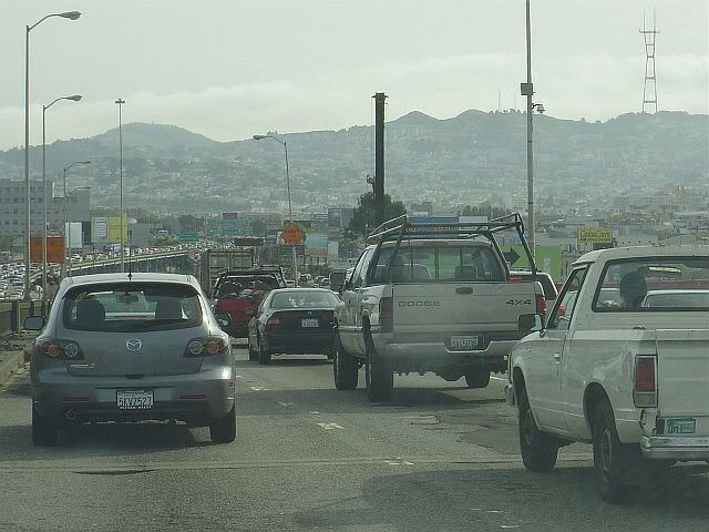
By the time the road descended from the mountains, I was thoroughly disgruntled by the quick pace of the traffic and the commercialism of Tahoe, so I stepped on the gas and pushed on to Sacramento. Unfortunately, my mood continued to disintegrate as my time in 'civilization' increased. As 50 approaches Sacramento it turns into Route 80. I have to admit that I became a bit emotional when suddenly all of the highway signs read 80W and I realized that 50 had ended with no recognition of any kind from the CA D.O.T. After 12 days of adventure all along the same road, this was just too unceremonious for me. I spent the next 90 miles towards San Fran trying to block out the eight lanes surrounding me and to re-live the calm and intimacy of two-lane 50.
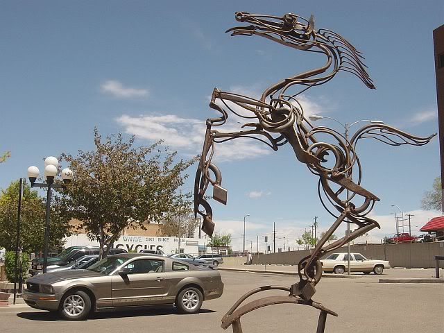
A stop in Sacramento's old-town district could have been interesting if I weren't already cranky when I got there. I'm sure there was fascinating history to be learned in the preserved waterfront area, if one could dig through the tourist shops and eateries to find it. A sculpture of a galloping rider denoted Sacramento as the end of the Pony Express route and further drove home the fact that my own trip was just about over and I would soon be parting from my own Pony.
Rather than barreling straight into San Fran, I've stopped in Berkely for lunch and to hopefully find some information about the Bay area. I'd still like to squeeze in a hike before tomorrow night's flight home, but first need to decide where the heck to stay tonight. Some funny (or not so) observations came to me while having oysters in Spenger's:
- By and large, 50 is definitely a rural route in spirit. In many of the small towns along the way, 50 becomes Main Street as it passes through. As it approaches larger cities such as Cincinnati and St. Louis, though, it joins up with larger highways to take a by-passing route around the edge of the city, until it can split off and become two lanes again on the other side.
- I saw a homeless person for the first time in 12 days, today along the riverfront in Sacramento. Granted, I by-passed Cincinatti and spent little time in St. Louis so I'm sure I missed the homeless populations there, but the sight was still unexpected after so many days in more rural atmospheres.
- In the family-style restaurants in which I've eaten most of my meals, I was generally seated in the middle of the restaurant, often at tables meant for several people. Here, at swanky Spenger's in Berkely, my lone, hiking-booted self was seated at a tiny little table in a corner by the fire exit. I may be reading too much into that, but considering that it's 2:30 in the afternoon and the lunch rush is clearly over, maybe I'm not.
Call me a curmudgeon, but I'm suddenly wishing I were back in eastern Nevada, with only ravens and golden eagles for company.

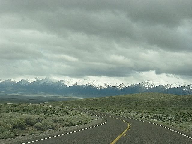
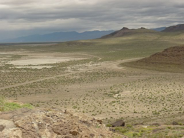
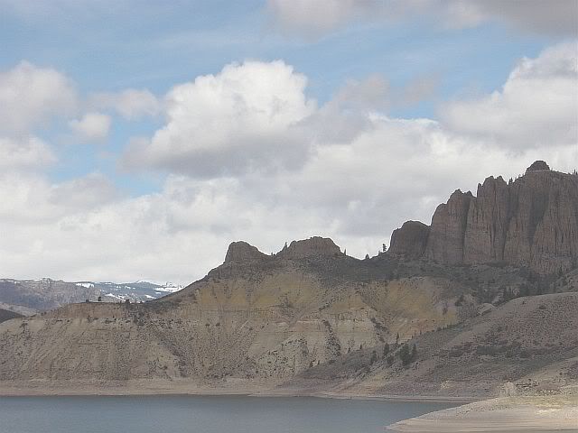
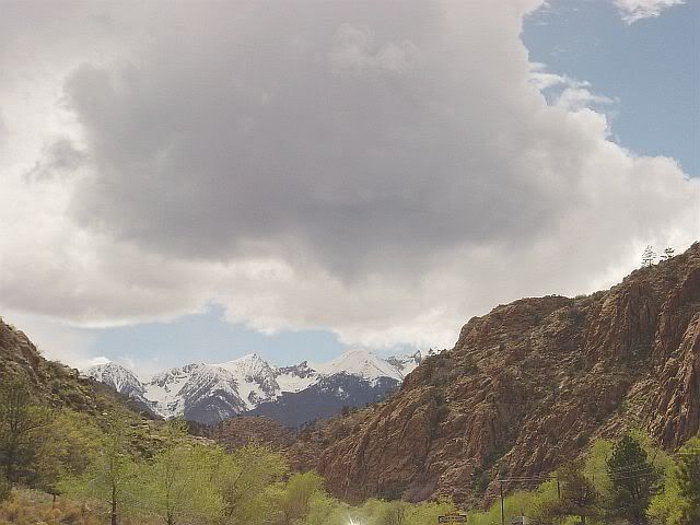
Today's weather threatened to be just like yesterday, but ended up being variably cloudy/sunny. After a quick continental breakfast at the hotel in Eureka, I headed back onto the road for a morning of more flats alternating with mountain passes. The brochure from Great Basin Nat'l Park explained that the flats are 'basins' left by the receding of the ancient seas that covered this area however many years ago. With this in mind, it's that much more interesting to crest a 7,500 foot pass and see that low flatness stretching for miles toward the next mountain range, and to imagine it all submerged in water.


The first stop today was in the first town I reached, Austin, which is 70 miles from Eureka. A tiny town clinging to a hillside at 6,700 feet of elevation, where I made a pit stop and picked up a pin proclaiming I had survived the "Loneliest Road" (even though I haven't yet survived it, I'm only halfway along it). Though surviving it now is hardly the challenge it was when the Pony Express riders galloped along the same route. I was surprised to learn that, for all it's gloried place in American history, the Pony Express was only in business for a total of 17 months during the U.S. Civil War.


The second stop would have been Hickison Summit Petroglyph Site, but the dirt road leading back to it had been converted to a mud pit by the previous day's snow and rain. I thought it best to not get the Pony stuck and just continued on.
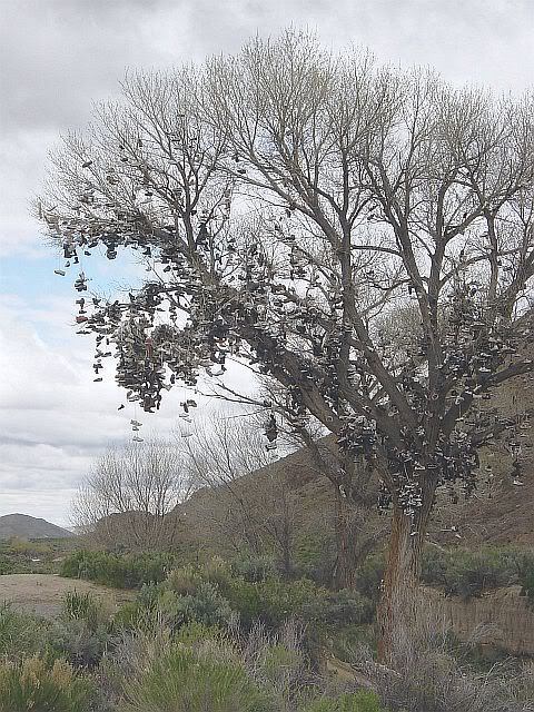
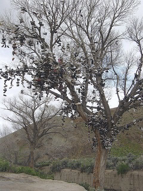
Made one unplanned stop next to the most amazing cultural marker I think I've ever seen: an old tree hung with shoes. It had obviously begun with some pair that had the laces tied together and then was flung across a branch, but people then became more creative. I saw a pair of cowboy boots that someone had strung together and then flung up. For how long have people been flinging shoes into this tree? What sort of history of shoe fashion could be written from analysis of the shoe tree's branches? Did the person who threw the first pair have any conception of what they'd begun? It was absolutely fascinating.


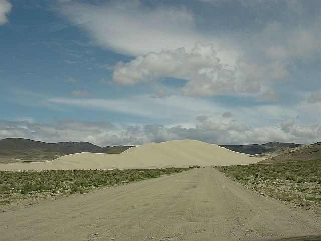
The third planned stop would have been Sand Mountain, a huge sand dune between a mountain range and a sandy, salty flat. I turned and headed along the pitted dirt road leading to it, but as I approached I could hear and see ATV's churning along the base of the dune. The noise and disruption made me again choose to move on, after snapping a couple of photos (including one of the solar-powered phone at the entrance, which a sign along 50 proclaims the "Loneliest Phone"). The passage along the sand flats was bordered by dozens of spots where people had apparently gathered rocks from the basin and used them to spell out names and slogans ("I love so & so", etc).

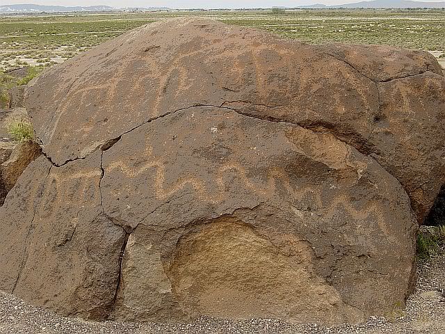
The fourth planned stop was Grimes Point Petroglyph Site, at which I was finally able to get in another hike. In spite of the great trail and the dramatic view from the overlook, there was an unfortunate disruption here, too: jets flying in and out of the air force base at Fallon, just a few miles from the petroglyph site. I had to keep telling myself that it was the wind blowing, not planes, just the wind...


While the petroglyphs were cool, what really gave me pause was an interesting sign at the overlook: In contrasting the life of hunter-gatherer tribes who entered the area 8000 years ago to life in the area today, the sign mentioned that the current population of the area is approximately 300,000 people within a two hour drive. The town of Gaithersburg, MD, where this trip began, has a population within it's town limits of almost 400,000. It's gonna be hard to go back home to that.
The fifth planned stop today was to be in Fallon because the Road Trip USA website mentioned a nifty sounding museum there, and I assumed that there would be places to eat (the military's gotta eat, right?). But, I couldn't find the Churchill County Museum and the food choices were so slim I ended up at Jack In The Box.
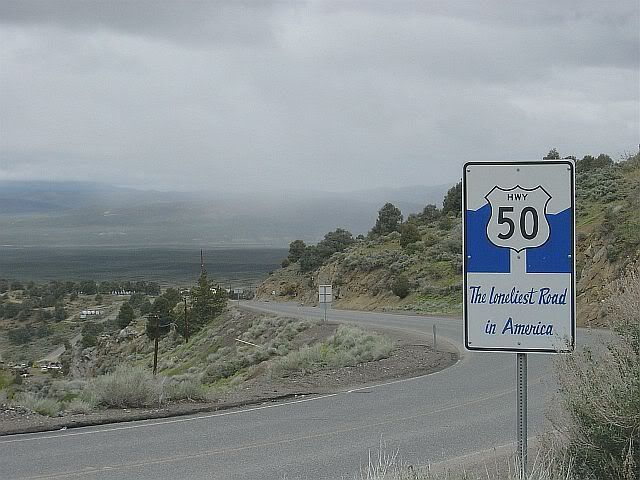
Technically, the "Loneliest Road" section of 50 runs all the way to Carson City, the capital of Nevada. It may as well stop at Fallon. West of Fallon, below the same sort of mountain ranges of the last few hundred miles, the basin area is scattered with ugly little pockets of mobile homes, single-story ranch-type houses, gas/convenience/casino combinations,and a whole lotta traffic. Took one detour up Route 341 to Virginia City and very literally up it was, too. A 15% grade snaking it's way up through the still functioning yet historic mining towns of Gold Hill, Silver City and then into Virginia City. It's pretty apparent that the producers of the old tv show Bonanza never actually visited the town in which the show supposedly took place. Either that or they decided that the aerial location of the real Virginia City just wouldn't translate well on tv.
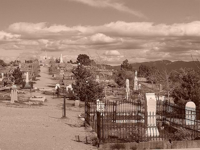
I was looking for the Red Light Museum (not a museum of traffic signals. Just as well that I didn't find it, considering the comments at that link), but instead ended up at the Comstock Cemetery, one of the coolest burial grounds I've ever seen. Flowing up and over a hill on the edge of the town were graves dating from the early 1800's through the present day. I'm guessing the oldest were the wooden grave markers that were so weathered as to be unreadable.


Heading back through the main street of Virginia City I tried again to find the Red Light Museum, but if it was there it was buried among the kitschy Wild West-style museums, "saloons" and souvenir shops that I never would have expected to find tucked away all the way up that road. There was even a Mark Twain museum (Twain spent a portion of his newspaper career in Virginia City). I could easily imagine Twain clucking his tongue at all the tourists wandering the town today.
After the awesome, empty openness of eastern NV, Carson City is one hell of a shock. It's like a mini-Reno, with it's own Nugget Casino and everything. I was fortunately able to find a funky little coffee shop, where I'm debating whether to find a hotel there or continue on to South Tahoe. I'm more than tempted to head back to Eureka, in the middle of the loneliest section of the Loneliest Road.
Wal-Mart count as of Carson City= 17, plus the 2 distribution centers.
(For more images of the Lonely Road through Nevada, click here.)

 Interesting day today. Pancakes & eggs at the Top City Cafe in Delta to start and then I headed back out into the flats of western Utah. More long, almost straight road through open range land. Bovine roadblocks were no problem today, as the only cows I could see were tiny little dots so far in the distance that I estimated having to walk at least a half mile towards them before they'd look normal-sized. Passed the supposedly dry Sevier Lake. There was apparently enough rain last night to water it at least a little bit.
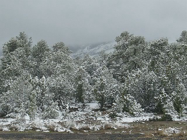
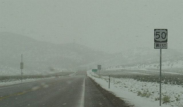
A note on the weather as a lead-in to the next stretch of road: Throughout this trip, conditions have been variably cloudy, with some periods of puffy clouds against clear blue and others of predominant clouds. The only rain so far has been a couple of short storms that've passed through at night while I've been tucked away in a motel. That all changed today. The thunderstorm that went through Delta last night was long gone, leaving rolls of low grey clouds that obscured the tops of the mountains ahead.

The rain started just as the road began to climb. Within a few miles, the rain had become snow and the clouds had thickened to a wall of white, leaving a visibility closer than the microscopic cows by Sevier Lake. The next 120 miles were long flats alternating with curvy climbs up and over seven-or-so thousand foot passes, with snow and those heavy, heavy clouds.

It sounds bad but, thanks to the Nevada D.O.T., the roads were perfectly clear and it was really one of the most beautiful and interesting parts of the trip. Eastern Utah may have been the most colorful and spectacular portion of Route 50 so far, but there's a lot to be said for the subtlety of snow-covered pinyon pines and the mystery of knowing there's a magnificent mountain range out there that just can't quite be seen.
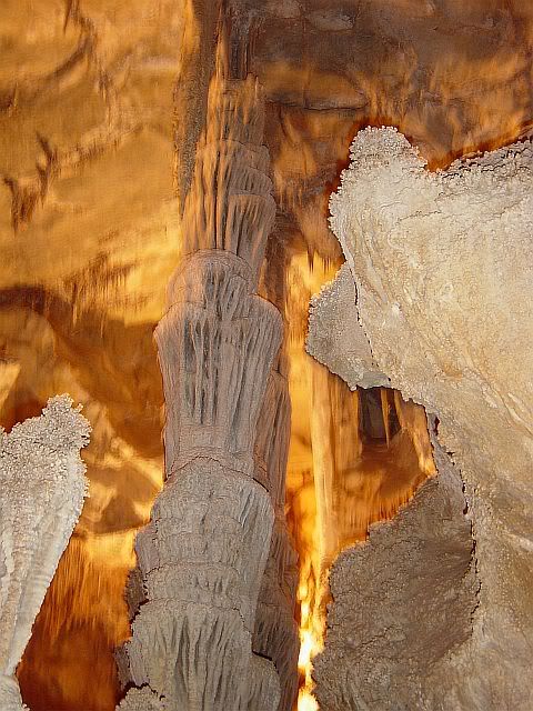
The only problem with today is that I just didn't plan for hiking through snow when I packed for this trip. I had wanted to hike at Great Basin National Park in Nevada, but that was out of the question. That left me with nothing to do but take the 60 minute tour of Lehman Caves at Great Basin, and drive.

I had also wanted to stop at the edge of Ely (E-lee, not E-lye), NV, for a photo of the sign proclaming the next stretch of 50 the "Loneliest Road", but there was a sketchy looking hitchhiker about 500 yards before the sign, so I thought it best to just go on. As a result, I've ended up in Eureka at 3:00 in the afternoon. After driving almost exactly 250 miles, it's either stay here or go another 110 to the next town. In the hopes that the weather will clear up overnight so that I can make more stops tomorrow, I've checked into another Best Western (which I think may be the only hotel in town). I could spend the evening in front of a slot machine at the Owl Club Cafe, where I'm having an Aly Special for dinner (roast beef, ham & tomato on toasted sourdough), but I'm not the gambling type.
Wal-Mart count as of Eureka, NV: Ha-ha. There were barely even any towns, much less big box stores!
(For more images from this day's drive, click here.)

Breakfast at the Aspen Coffee House in Fruita, CO, a handful of miles from the Utah border. Yesterday was a bit harsh, hence the lack of notes. I do believe the Colorado altitude kicked my butt. That, and the trail that I hiked at Curecanti Creek, in Curecanti National Recreation Area. Descended 900 feet within 2 miles through rock, pine, aspen, then scrubby oak, sagebrush and more rock. Then, the same going back up. All of this beginning at an altitude of 7000 feet or so. I had no problems with my asthma (I bow to the creators of Advair), but I thought for sure my heart was going to burst.

So, afterward, the rest of my drive through the mountains of CO was pretty subdued. I didn't even take many more photos, aside from a couple of Dillon Pinnacle.

(Click here for more photos from Curecanti Creek and Dillon Pinnacle on Day 8.)
This was also the first day of the trip that I haven't crossed a state line. I pooped out here in Fruita, which is a funky little mountain bike- and dinosaur fossil-oriented town next to the Colorado National Monument, just a handful miles west of the Utah border.

Heck with yuppified, overpriced-gas Gunnison, I think I'd rather live here in Fruita. I've been sitting in the window of the coffee shop, looking at the sculptures along the sidewalks and at the wall murals, and noticing that the younger generation takes their coffee inside with newspapers and laptops, while the old-timers carry their cups outside for conversation on the street corner. Even the old dudes are wearing hiking boots.
But yet again, my dreams were smashed. Took a quick cruise through the residential district of Fruita. Similar to Gunnison, with little bungalows and single-level ranch-styles. And then... at the edge of town were not one but two brand spanking new, totally tree-less subdivisions. The devil developers strike again.
Just over the border into Utah, passed a big yellow road sign warning "Eagles In Highway". Sure enough, within a few miles I drove past one perched on the guardrail.
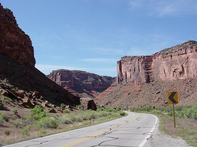
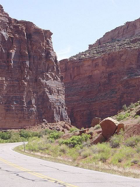
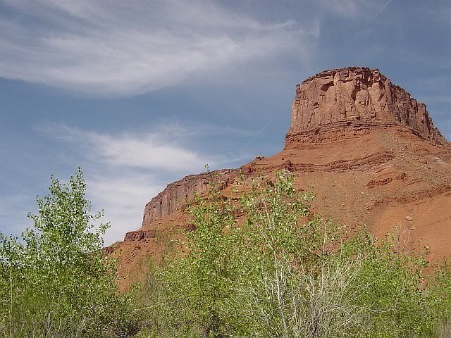
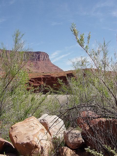
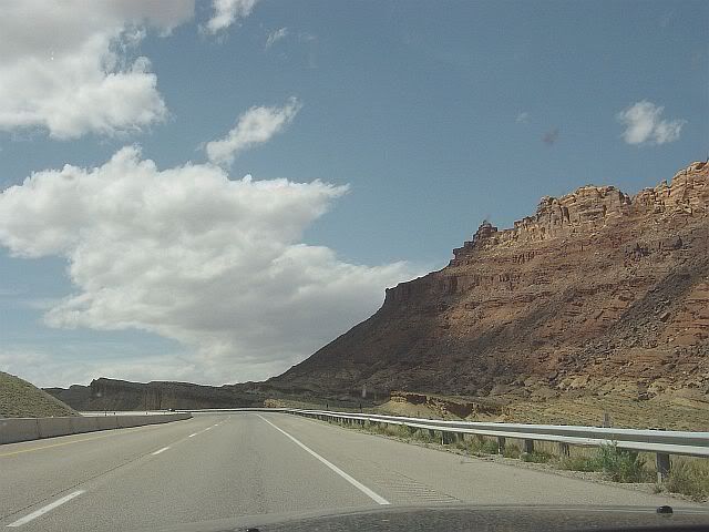
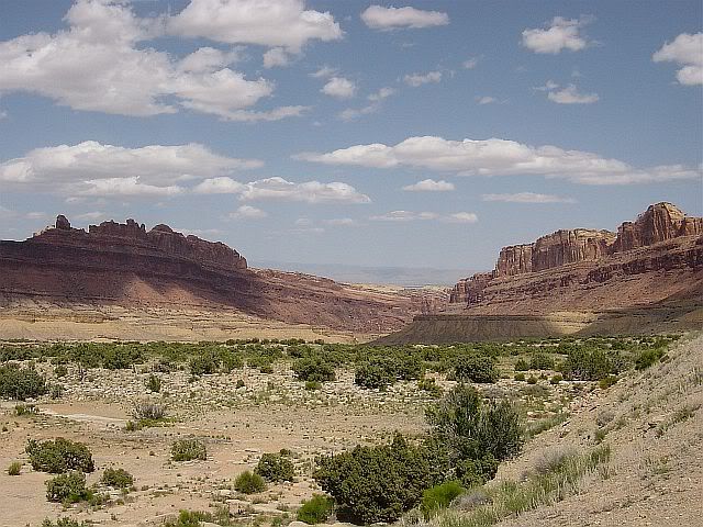
Today is my first pre-planned extended detour, to Moab, UT, home of slickrock bike riding and Edward Abbey. To begin, let me say that anyone passing through southeast Utah absolutely must drive the scenic byway of Route 128. A mile or two from the exit off of Highway 70/Route 50, is a sign that reads: "Beyond this point motor vehicle traffic is limited to paved roads and trails". This road is awesome Pony land and yes, I mean Ford Mustang, not horse. Two lanes very gradually descending westward through open range land, full of hills, dips and curves, with red rock mesas along the horizon. The Pony took it a bit above the posted speed limit, while I hovered my foot above the brake as we climbed each hill, for fear of finding a bovine roadblock just over the top. After a few miles of this, the road entered a gorge along the class II-III Colorado River. Through this stretch the scenery kept me at the speed limit as much as the hairpin turns did. I swear I bumped my lower jaw on the steering wheel a few times from gaping at the view.


(For these and more photos of Utah, click here.)
43 miles later, Route 128 comes out at Moab, where I had lunch at the Peace Tree Juice Cafe (great recommendation from Susan at the Back of Beyond bookstore). Moab is pretty cool, as long as you can see past the yuppie-pandering river/mountain bike outfitters and overpriced gift shops. Gas is back up to $2.36 a gallon, so that tells you a lot about Moab. I'd give anything to have been able to see it in Abbey's time, though, when the tiny bars of Moab were filled with cowboys and miners rather than spandex clad yuppies. Or even better, to have seen it before then, when there was no town, no bars, and no outfitters, just indigenous peoples who felt no ownership over the land. While I appreciate many of the conveniences of progress and development, I'm seriously brought to tears sometimes thinking of what's been destroyed in gaining those conveniences, and infuriated by people who can't even begin to imagine the world without them. If you're so inclined, here are Abbey's thoughts on the issue. The man expressed it better than I could ever hope to.
I had planned to do the tourist thing at Arches National Park, but there were so many other tourists already there that I let them all do it for me. Instead I hit the highway or, more accurately, the interstate. Back near the Colorado border, 50 merges with Interstate 70 and stays that way more than halfway across Utah.
And, I find I misjudged Moab's gas prices. Apparently, any station in UT anywhere near a highway runs from $2.36 to up as high as $2.45. I guess the fact that people have to drive as far as 110 miles between stations gives the station owners license to jack up those prices.
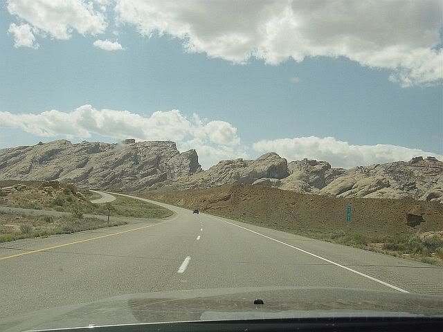
At least there are plenty of restrooms, though. Scattered along 70/50 are numerous "view areas", pulloffs at particularly scenic spots with one or two interpretive signs about the area and a teeny restroom with pit toilets. I had to wonder if someone really had the forethought to plan those view areas into the highway design, or whether there were more than a few traffic accidents caused by people trying to pull off the shoulder of the highway to gawk. Which is worse: to slam on the brakes to pull over for a photo, or to hold the camera up with one hand and snap a shot while speeding along at 70 mph? Hmmmmmm...


The landscape certainly is tremendous, too. There's such variety in the rock formations and colorations as the road passes through different areas that I wish I had picked up a geology guide at the bookstore in Moab. I have to admit, though, that I began to feel a bit uncomfortable at the lack of trees. Looking at all that rock and nothing above it but sky made me feel that spending a prolonged time in the area could fry your brain and make you crazy. As the interstate neared Salina and entered the Fishlake National Forest, the sight of pine trees climbing the mesas was a relief.
At Salina, 50 splits from 70 and takes a jagged course north, then south, then north again before heading west to Delta. By doing this, it manages to slip through a pass in a snow and pine covered mountain range, instead of climbing up and over like it did at Monarch Pass in CO. As spectacular as eastern UT is, I really enjoyed this stretch through Fishlake. It felt good to be back on two lanes. There's just something more intimate about two lanes and a single dividing line. It's almost as if you're in the scenery, as opposed to barreling through it (even if the speed limit on those two lanes is a breezy 65 mph).
Coming out of the Fishlake forest area was interesting. It was almost like being in Kansas again, except that instead of prairie was sand and those prolific sagebrush bushes. I swear, though, that the horizon was even farther away than in Kansas. Either that or there's just more sky in Utah. Whichever it is, it felt as if I could literally see for 30 miles across the total flatness, with utility poles and road heading off in the distance until they were microscopic. Delta, where I ended up at Best Western for the night, is 88 miles from the Nevada border but I have a feeling I've been given a preview of what to expect when I cross the state line. And speaking of expectations, a traveler through central Utah can't expect much in the way of accommodations. Delta's so tiny that Best Western is the only chain motel and I had to make do with McDonald's for dinner. Tomorrow will be even more stringent-- the 88 miles to the Nevada border looks on the map to be a stretch without a single town.
Wal-Mart count as of Delta, UT= The same as yesterday! I've seen not one Wal-Mart in Utah, though I did pass a few of their trucks.
Today's distance= 329 miles, including the 75 miles down to Moab and back up.
Morning in Gunnison, CO, finds me a bit groggy. I'm wondering whether the headache I have is due to altitude or to having woken up ravenously hungry. Breakfast has been a quest, though, thanks to all the folks in town for Western's graduation. Tried to go to Bean, the funky coffee house mentioned at the Road Trip USA website, but the sidewalk outside was packed with people waiting to get in. The two deli-type places on either side were also crammed. So I drove back down the street to the Quarter Circle Restaurant, a family joint across from the motel. Still had to wait for a table, but I've got high expectations for the revivifying effects of their silver dollar pancakes.
See Day 9, Colorado to Utah, for more notes and photos from Day 8.
Last night's storm passed through with some ferocious winds and not much rain. Started out today with a bright blue sky and rolls of cumulous clouds here and there along the horizon. Fifty miles west of Lamar, the road headed up a rise and around a curve, and all of a sudden, off in the distance, there were snow-covered mountains.
Flat behind, mountains ahead, bug residue on the glass.

Stopped in La Juinta for a quick break and noticed on the main street: an Elk's lodge with a life-sized fake elk on the balcony above the entrance, a store named "Smoker Friendly" (Don't have to guess what they sell. This ain't the politically correct East.), and Muzzy's Mexican Cafe. It's also apparently home of the Koshare Indian Museum, but I didn't see that.

Stopped in Pueblo for lunch. When I was a kid, I recall seeing ads on tv for public service pamphlets that you could send away for. The address for them was always in Pueblo, CO. Come to find, Pueblo's got a semi-bustling, artsy, hippy/yuppie-fied downtown district complete with a Riverwalk along the concrete enclosed Arkansas River. Reminds me a bit of the historic section of Frederick, MD, with its "linear park" along a similarly enclosed Carroll Creek, though Pueblo's got more landscaping and sculpture along its tamed waterway.


Lunch at the Rio Cafe in Pueblo. Joy, the waitress, asked what I was reading. After I explained the premise of Blue Highways, she mentioned that she'd always wanted to take a road trip like that. She then got really excited when I said that I was in the middle of one. She even brought out the proprietress/chef of the cafe and told her about it. Turns out the proprietress is from Delaware & has a boat on the Chesapeake Bay in MD, so we ended up talking MD crabcakes. Joy then began telling me about Pueblo. Apparently, if you're into Italian food, Pueblo's the place to go. In addition to a (non-surprisingly) Mexican population, there's a large Italian community. I wasn't sure whether to believe it, but she told me that an entire Sicilian village had emigrated to Pueblo way back when. Mexican's and Italian Mafioso, what a combination. The Rio Cafe, by the way, is of German influence. From the sound of that day's specials, I was sorry I wasn't there for dinner time.
Heading back to 50 through the north section of town, I cruised through a strip that I swear contained every single motel, big box store, chain eatery, and car dealership ever invented-- except for Wal-Mart!
Immediately after Pueblo came the Royal Gorge and Monarch Pass. Seventy-five miles that left me pop-eyed and slack-jawed (and white-knuckled a couple of times). Like the Tallgrass Prairie in Kansas, I'm afraid of describing it for fear of sounding trite, so I'm going to stick to detail and hope my photos communicate the grandeur of it. At the edge of the Pueblo suburbs, the surrounding landscape was tan-colored rock and scrubby shrubs, with immense jags of snow-covered mountain in the background. As the road entered the Royal Gorge area, the Pony and I found ourselves back into the sort of climbing 'S' curves we enjoyed so much back in WV, except that these went on and on and on through rocky red hills scattered with pines.


To the right of the road twisted the apparently very popular Arkansas River (there were almost as many rafting/camping/climbing outfitters along the road as there were pine trees). White-knuckle moments #1 & 2 came through this stretch, when I had drivers coming towards me decide to pass slower cars as they were coming around curves. Once it was a big ol' white pick-up truck, then it was a motorcycle, which really freaked me out. Heading up out of the gorge area, though, the traffic thinned as the road climbed. I caught myself literally gasping over the view around just about every curve and I had to fight the urge to take one hand off the wheel and try to get some windshield photos. (I admit it, I gave in to the urge a few times. One of the few benefits of automatic transmission.) We then began to seriously climb and the snow got closer. At 11,312 feet, the road crested Monarch Pass and started back down.

The Pony handled the curves like water flowing down a stone, but that didn't prevent white-knuckle moment #3: Coming around a blind curve to find that there was no longer a guardrail on the opposite, downhill side of the road. If I had to drive back up Monarch on that side of the road, I think I'd do it at about 2 mph and hug the dividing line all the way. Below snow-line, it was back to slightly looser curves and rocky, scrubby slopes. Added to the scene now were stands of Aspen trees, for which Colorado is so well known. And then... coming over a small rise, I saw it: A downhill slope and a loooong straightaway, with three cars in front and no one coming towards me. I couldn't resist. I moved over the divided yellow line and... Let's just say I let the Pony stretch its legs. Nothing like awesome landscape and a good adrenaline rush to put a grin on your face (well, my face, at least).
And now, eating dinner in Gunnison after checking in at the Quality Inn, I feel lucky to have gotten a room, considering this is apparently graduation weekend for Western State College, which is smack in the middle of town. This is a cool little place, though. A college town with such a bevy of outdoor adventure opportunities is my kind of place. I drove through the side streets drooling over all the charming little bungalows and Craftsman homes. Is that a sign of age, that I cruised town checking out cute houses instead of cute college boys? I will admit, though, that the obvious yuppie-fication of Main St. is an unfortunate drawback of just the elements that I find appealing in places like Gunnison. After 2,000 miles of gas prices ranging from $2.03 to $2.19 - Hell, gas was $1.90 in Hutchinson, KS! - it's up to $2.38 here in Gunnison. I also saw my first damned, gas-guzzling, oversized-hunk-of-metal Hummer of the trip, parked in a driveway near the college. So much for paradise in CO.

(For more images, click here.)
Observations: Ohio, Indiana, Illinois & Missouri were fun and interesting because I had no pre-conceived impressions of them, no real idea of what the landscape would be like. Kansas was close to what I expected (though I didn't anticipate the wind). Colorado, though, so far is exactly what I'd pictured, though no less interesting and appealing.
Wal-Mart count as of Gunnison, CO= 15, plus 2 distro centers.
Today's distance= 393 miles.
I'm not sure what day it is. Counting back tells me it's Friday, but it feels like Saturday. I'm tired and disoriented, but isn't that what a road trip is all about?
Another symptom of being saddle-sore: I've developed a blister at the base of my left index finger from gripping the steering wheel so many hours a day.
An overcast morning in Hutchinson, KS, reveals more evidence of what seems to be a fairly artsy community. In hunting down a spot for breakfast, I've seen an art center, a music store, a big street-corner wall mural, and wind-blown leaves painted on the garage door of a building across from Jeannette's Cafe.


I also noticed a big bike shop (bi-, not motor-) and a bike trail down at Carey Park. Oh, and Hutchinson is also home to the Kansas Cosmosphere & Space Museum, which apparently rivals the Smithsonian Air & Space Museum in Washington, DC. Personally, I'm more interested in the bike path.
A word or two about Jeannette's Cafe are in order: As I was leaving after breakfast, I commented on the beautiful Art Deco fireplace along the wall and asked what the building had originally been used for. Jeannette (I think) told me that downstairs had been a bar, which made sense, considering the old wood counter and mirrors on the wall behind.

Upstairs, though, had been one of three brothels in Hutchinson that were referred to as the "Three Queens". If she hadn't been minding the shop alone, she would have taken me upstairs to see: a long hallway lined on one side with doors, with a window in each door. Apparently, a cashier sat at the top of the stairs, taking "admission", and the customer would then peruse the "entertainment" in each window. Upon making his choice, he'd enter that room, pull the curtain on the door/window, and... conduct his business. This is the kind of quirky history I was hoping to find in these small towns.
Swung up off of 50 west of town to check out Quivira National Wildlife Refuge, established to protect the salt marsh of Kansas. No hiking trails to speak of, but I drove around a bit and enjoyed the scenery.

Observation: Kansas does not believe in paved roads. I had noticed yesterday that most of the roads bisecting 50 were dirt, then today I got to cruise along 8 miles of dirt & gravel to get to Quivira. The Pony needs a bath now. Speaking of the Pony, on the way back to 50 from Quivira, it was almost sideswiped by a pheasant. I slowed down when I saw the bird, with it's long, colorful tail, strolling out of a field, but then it took off into the road towards the car, startling the crap out of me before veering away right next to the passenger window. If the car had been sitting still, I might have enjoyed the sight of a huge pheasant with outspread wings just a bit better.
I think Kansas is going to wear me out. It's taking me two days to get across the width of it, and now I'm having to fight to keep the wheel straight through some hellatious wind gusts. That and watching the Pony's hood quiver every time an eighteen wheeler roared by made me pull over for a break at Kinsley, KS, the "Midway of the US".
Duh... I was miles down the road before it dawned on me that I should have taken a photo of the Kinsley sign. I was so braindead, I saw that one half of it pointed west and said "San Francisco 1571 miles", but didn't read the other side. I can only assume the other half said Ocean City and the same mileage. Would have been a great trip photo.
Did the tourist thing in Dodge City, KS, land of Wyatt Earp. Admission to the museum and what's left of Boot Hill Cemetery was 7 dollars and it took me about that many minutes to walk through it. It was so cheesy and tourist-ified that I didn't even bother turning the camera on. Now I'm waiting for lunch in a real "West-arn"-style restaurant and listening to the young guys at the next table discuss the consequences of one of them getting his girlfriend knocked up. God Bless America!
Despite trying to maintain my sense of wonder and curiosity, and the genuinely cool things that I have seen in Kansas, I'm looking forward to "getting out of Dodge" (ha-ha) and heading to Colorado.
So far, western KS has been my least favorite part of the trip. If it hadn't been for the stanky cattle feedlots everywhere and being paranoid of some huge truck blowing the hood off the car, I probably would have gotten more out of it. I certainly did get a kick out of trying to figure out how far I could see to the horizon. Of note along the way:
- The type of roadkill has been quite different in western KS. Through the eastern states, it was mostly possum, raccoon and the occasional whitetail deer, which is what I'm familiar with from back home. Out here, it's been hawks and pheasant and, thanks to some careless driver, I've now seen my first (dead) coyote in the wild.
- Passed by Holcomb, KS, on the way to the border of CO. If you want to know why that's significant, go read Truman Capote's In Cold Blood (or find the movie, starring a young Robert Blake. Hmmm, interesting that Blake starred in that movie, then recently ended up on trial for the death of his wife... Life imitates art imitating life?)
Made it across the border into Colorado and headed straight toward a storm-front. Puffy white clouds to the north of 50, puffy white clouds to the south of 50. Directly to the west, in front of me, a wall of grey and the occasional lightning strike. Ended up not driving far enough to hit rain, though. Stopped at the Best Western in Lamar.

After dinner in the hotel I stood along the edge of the parking lot, overlooking a stretch of cow field. The wind was literally howling through the electrical wires running overhead and making the wires whip around in an alarming way. It almost sounded as if the prairie might be trying to blow the town away. I kept looking for a crotchety old woman dressed in black to ride a bicycle across the sky.
Wal-Mart count as of Lamar, CO= 12, plus 2 distro centers.
Today's distance= 305 miles.